Pointing Dish Network
Winegard(tm) Carryout(tm) Anser Antenna is a portable satellite system that required a user elevation setting to automatically acquire the desired satellite.
Winegard Anser Antenna
As the user, you will need to know which satellite you would like to view and the corresponding elevation angle for that satellite.
Under “Compatible Satellites,” different popular satellite options are outlined along with the programming offered via each satellite.
Elevation and coverage maps are also included to help you determine the correct elevation angle and coverage for certain satellites.
The Anser Carryout Antenna for use with Dish Network and Bell TV, and DirectTV.
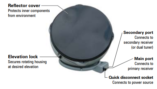
Parts Of Antenna
Antenna in Deployed Position
Antenna in Stowed Position

Simple step Installation Anser antenna
- Find elevation angle - via receiver menu or provided maps*.
- Hook up the antenna - manually set the elevation to the correct elevation angle for your area.
- Get to the signal meter-screen on your receiver.
- Plug in the unit—the unit will search and find the strongest signal.
- If the system stops-on a signal but is not on the desired satellite for viewing, the unit will move to the next signal found in 45 seconds.
- Once you have signal on your desired satellite - unplug the power to the unit.
- Watch TV!
How To Pointing Antenna ?
The Principle of Pointing an Antenna, you need only two information, The information about the Azimuth and the elevation number that point the antenna to the Satellite that will serve your receiver ? 
picture courtesy : promaxelectronics.com
See the picture describe the Azimuth the position of antenna from the North compass and the Elevation is the corner degree antenna from horizon .
Just the simple like that...
*Elevation angles may not be displayed in the receiver menu for satellite 72° (recommended as a single satellite
solution for DISH®
HD programming) or 129°.
If the elevation angle is not displayed in the receiver menu, use the provided elevation and coverage maps to find the elevation angle for your current location.
If the elevation angle is not displayed in the receiver menu, use the provided elevation and coverage maps to find the elevation angle for your current location.
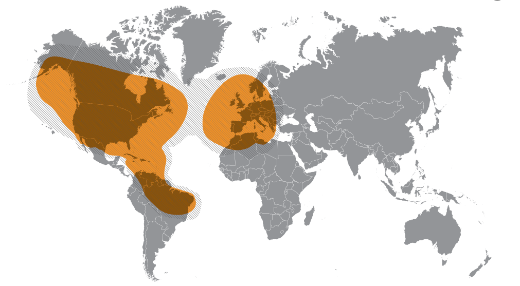
Compatible Satellites
For Dish Network
Set To :
72°: Eastern satellite, recommended
for HD programming
129°: Western satellite, majority of
HD programming
119°: Majority of std. programming
110°: Some standard programming,
limited HD programming
How to use the maps ?
Example :
Your current location is in Colorado, and satellite is Dish 72 for HD Programming. Find your Elevation ?
Answer :
So look at Dish 72 Map below , for Colorado elevation is 33, so adjust your elevation to 33 degree from Horizon.
I attached a US map to make it easier to find your location and match the elevation map


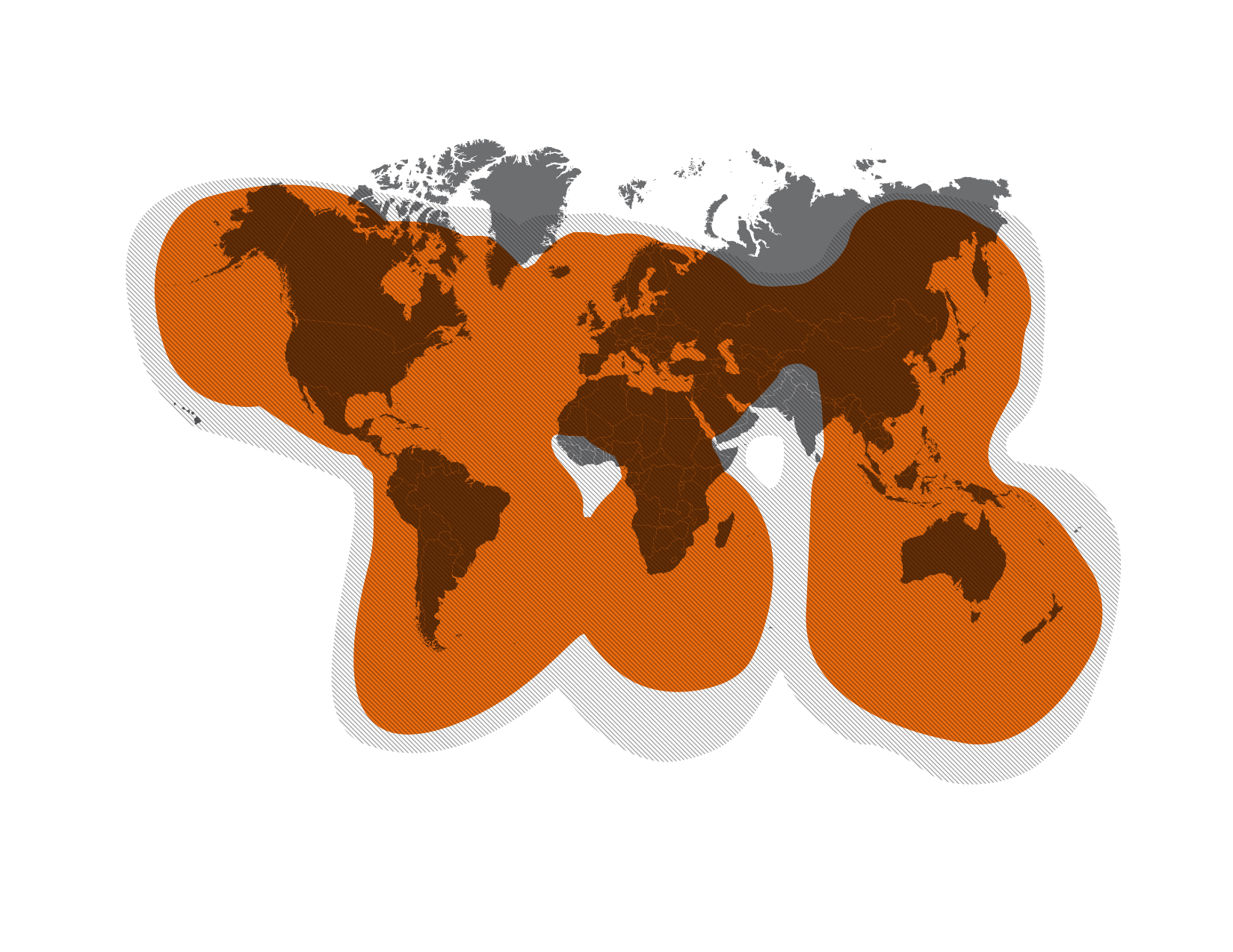
Here the lists elevation maps
Maps For Dish Network
Elevation Maps
How to use the maps ?
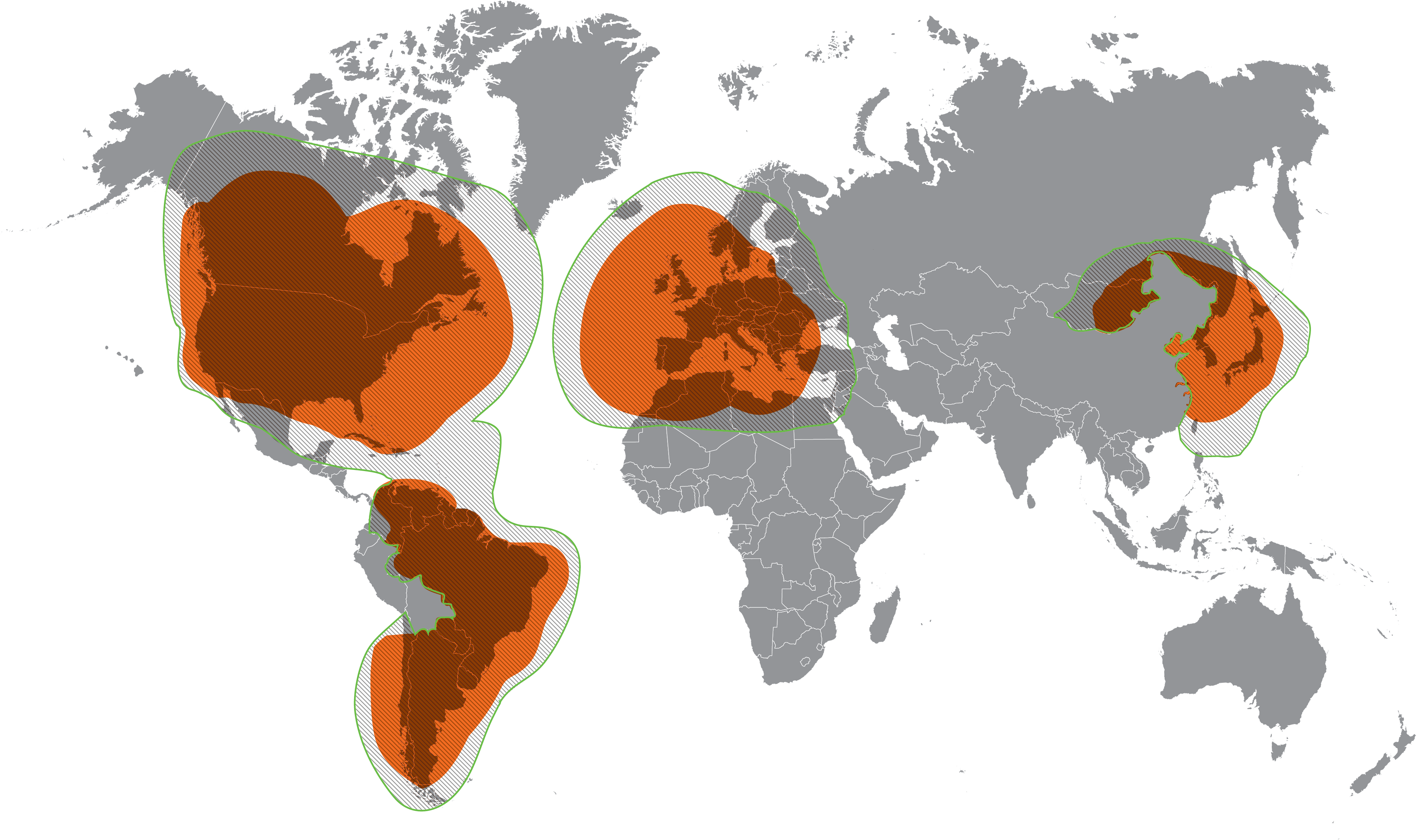
- Determine which satellite you want to point at - Maps are provided for Dish 72, Dish 110, Dish 119, Dish 129, DirectTV 101, Bell TV 82, and Bell TV 91.
- On the corresponding map-find your location.
- Determine the elevation angle- closest to your current location.
- Use this elevation angle to help point your antenna- Keep in mind that the elevation angles provided are approximate.
- If having trouble-locking onto signal with the elevation angle provided, try adjusting the angle ±2–3 degrees.
Example :
Your current location is in Colorado, and satellite is Dish 72 for HD Programming. Find your Elevation ?
Answer :
So look at Dish 72 Map below , for Colorado elevation is 33, so adjust your elevation to 33 degree from Horizon.
I attached a US map to make it easier to find your location and match the elevation map


Here the lists elevation maps
Maps For Dish Network


Maps for DirectTV

Maps for Bell TV


TIP
The 72° satellite is recommended as a single satellite solution for
DISH®
HD programming. In the Northwest, the extremely low elevation
angle may present issues in getting clear line-of-sight to the satellite.
In those circumstances, use one of the western satellites (110°, 119°, or 129°).
Note that the 72° and 129° satellites require an HD receiver. circumstances, use one of the western satellites (110°, 119°, or 129°).
Note that the 72° and 129° satellites require an HD receiver.
In those circumstances, use one of the western satellites (110°, 119°, or 129°).
Note that the 72° and 129° satellites require an HD receiver. circumstances, use one of the western satellites (110°, 119°, or 129°).
Note that the 72° and 129° satellites require an HD receiver.
Here is Video Dish Azimuth and Elevation Pointing for your reference.
Reference : Winegard manual Dish Network